
Chester County ZIP Code Directory Coverage
County GIS reports 43 mapped postal polygon areas in Chester County. The detailed research table identifies 42 named postal rows, reproduced below; it does not name a code for the remaining mapped polygon, so no unverified ZIP is added here. Each documented row keeps the County's post-office name and describes only the County portion of its polygon. That matters at the edges: a postal area may extend into another county, while an address with a familiar postal name may fall in a different borough or township. The dataset excludes onsite P.O. Box delivery areas, and the County cautions that ZIP polygons are generalized rather than exact boundaries.
| ZIP | County coverage / published postal name | Post office | County dataset note |
|---|---|---|---|
| 17527 | Gap polygon portion | Gap | Cross-county postal geography. |
| 17555 | Narvon polygon portion | Narvon | Cross-county postal geography. |
| 19073 | Newtown Square polygon portion | Newtown Square | Eastern County postal overlap. |
| 19087 | Wayne polygon portion | Wayne | Postal, county, and municipal lines differ. |
| 19301 | Paoli | Paoli | County ZIP polygon. |
| 19310 | Atglen | Atglen | County ZIP polygon. |
| 19311 | Avondale | Avondale | County ZIP polygon. |
| 19312 | Berwyn | Berwyn | County ZIP polygon. |
| 19317 | Chadds Ford | Chadds Ford | County ZIP polygon. |
| 19319 | Cheyney | Cheyney | Small polygon; verify delivery address. |
| 19320 | Coatesville | Coatesville | County ZIP polygon. |
| 19330 | Cochranville | Cochranville | County ZIP polygon. |
| 19333 | Devon | Devon | County ZIP polygon. |
| 19335 | Downingtown | Downingtown | County ZIP polygon. |
| 19341 | Exton | Exton | County ZIP polygon. |
| 19342 | Glen Mills | Glen Mills | County ZIP polygon. |
| 19343 | Glenmoore | Glenmoore | County ZIP polygon. |
| 19344 | Honey Brook | Honey Brook | County ZIP polygon. |
| 19345 | Immaculata | Immaculata | Small institutional-style polygon. |
| 19348 | Kennett Square | Kennett Square | County ZIP polygon. |
| 19350 | Landenberg | Landenberg | County ZIP polygon. |
| 19352 | Lincoln University | Lincoln University | County ZIP polygon. |
| 19355 | Malvern | Malvern | County ZIP polygon. |
| 19362 | Nottingham | Nottingham | County ZIP polygon. |
| 19363 | Oxford | Oxford | County ZIP polygon. |
| 19365 | Parkesburg | Parkesburg | County ZIP polygon. |
| 19372 | Thorndale | Thorndale | Small polygon; verify delivery address. |
| 19373 | Thornton | Thornton | County ZIP polygon. |
| 19374 | Toughkenamon | Toughkenamon | County ZIP polygon. |
| 19380 | West Chester | West Chester | Postal name is not one municipal jurisdiction. |
| 19382 | West Chester | West Chester | Separate West Chester polygon. |
| 19383 | West Chester | West Chester | Small institutional-style polygon. |
| 19390 | West Grove | West Grove | County ZIP polygon. |
| 19406 | King of Prussia | King of Prussia | County-edge polygon. |
| 19425 | Chester Springs | Chester Springs | County ZIP polygon. |
| 19453 | Mont Clare | Mont Clare | County-edge polygon. |
| 19456 | Oaks | Oaks | Small County polygon. |
| 19460 | Phoenixville | Phoenixville | County-edge polygon. |
| 19465 | Pottstown | Pottstown | County-edge polygon. |
| 19475 | Spring City | Spring City | County-edge polygon. |
| 19520 | Elverson | Elverson | County-edge polygon. |
| 19543 | Morgantown | Morgantown | County-edge polygon. |
Use the postal label as a geography clue, then verify the specific delivery address and the municipal jurisdiction. The County's 73 municipalities, their permit records, and their local code files do not align neatly with postal names.
Chester County Postal Areas on the GIS Map
ChescoViews makes the mismatch visible because it can show ZIP boundaries alongside parcel and municipal layers. The map is useful for comparing broad postal geometry, not for declaring a precise line. County GIS states that the polygons have ZIP_CODE and PO_NAME attributes and that they exclude onsite P.O. Box delivery areas. For precise statistical work, the County advises Census ZCTAs rather than its postal polygon layer. A searcher working with an individual address should use the map as context and then check delivery service.
The County ZIP polygon dataset description is the published source for the mapped-area count, fields, and limitation.
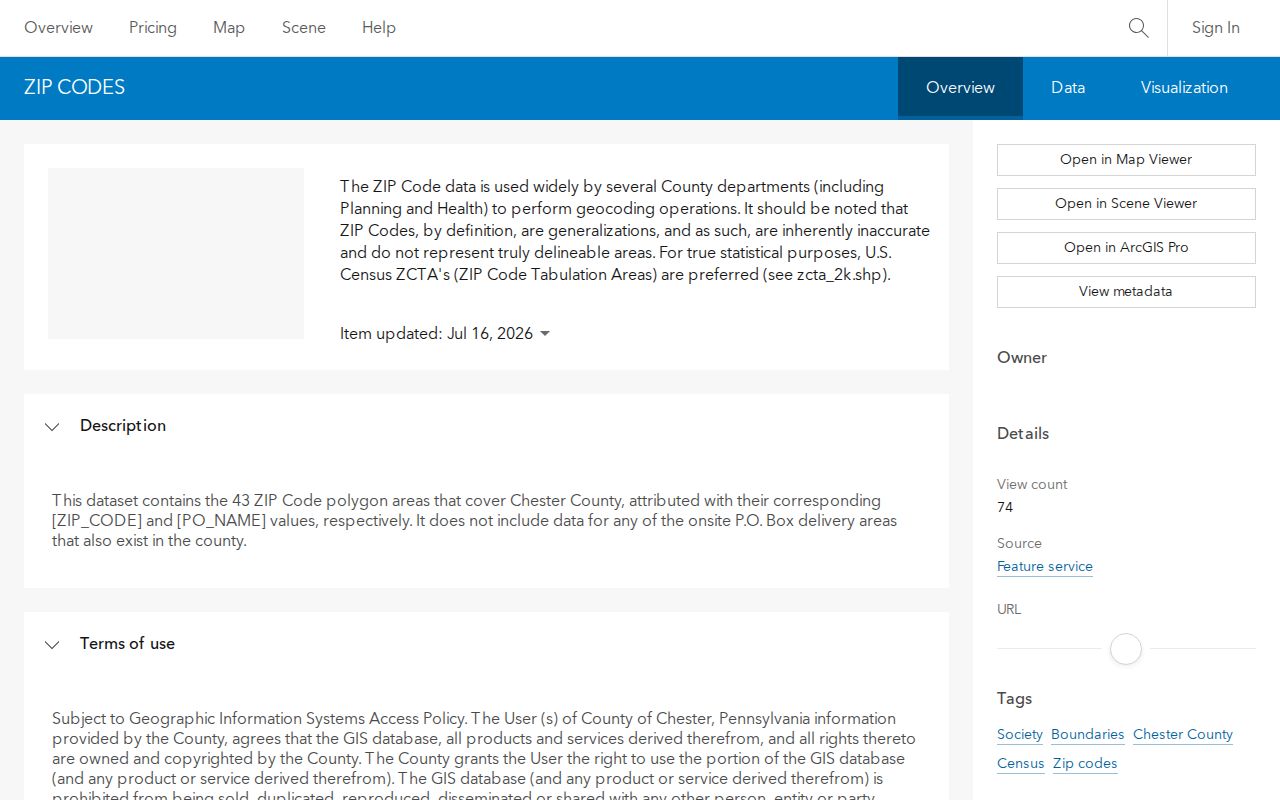
The image documents a data layer, not an address lookup result. It supports a countywide postal comparison but does not establish residence, property ownership, or a municipal service area.
Note: A postal area can help sort a request, but the municipality where the parcel sits remains the keeper for local permits, zoning, code, and occupancy material.
West Chester ZIP Code Directory Comparison
West Chester is the clearest local example of why postal labels need context. The County layer shows three separate West Chester polygons: 19380, 19382, and 19383. A West Chester mailing name therefore cannot, by itself, identify a single borough or township jurisdiction. The parcel's municipality and the UPI or PIN answer different questions from its postal code. County-edge labels tell the same story, with Wayne, Phoenixville, Pottstown, Morgantown, and King of Prussia appearing as postal names in the Chester County polygon data.
| Question | Best local key | What it answers |
|---|---|---|
| Where does mail go? | Postal code and exact delivery address | Delivery and addressing context. |
| Which local office has permit or zoning material? | Municipality | The proper local custodian. |
| Which land record belongs to this property? | UPI or PIN, then legal description | The parcel-to-Recorder bridge. |
This comparison is a practical Chester County geography rule. ZIP, municipality, and parcel are related keys, but none can replace the other two.
Find a Chester County ZIP Code Record
No verified Chester County portal from the research sweep lets a visitor search every resident or every parcel by postal code alone. ChescoViews documents ZIP boundaries as a map layer, not as a parcel-search field. The Recorder lists homeowner name, document number, book and page, and UPI rather than a postal filter. UJS uses party, county, docket, and date filters. The careful route begins with a delivery address and ends with the record system that has the needed field.
- Enter the full delivery address in USPS ZIP Code Lookup and retain the returned postal information for that address.
- Compare the address in ChescoViews with the ZIP boundary and municipality layers. Confirm the parcel's governing municipality before asking for municipal records.
- Search ChescoViews by address, street, owner name, UPI, PIN, municipality, or intersection. Keep the UPI or PIN when a property trail is needed.
- Use that parcel key, owner name, document number, or book and page in the Recorder route. For a street-level follow-up, use the Chester County street directory method after the location is narrowed.
USPS ZIP Code Lookup is the official delivery check for one address.
USPS verifies delivery context for an exact address. It does not replace the County parcel map, the municipal jurisdiction, or the Recorder document search.
Chester County Parcel Keys After a ZIP Search
Once a postal area has narrowed the place, ChescoViews supplies the local bridge into property research. The County describes it as a free, read-only land-record and map application. It accepts Address, Owner Name, UPI, PIN, Street Name, Municipality, and Street Intersections. A selected feature is highlighted and zoomed on the map, while the Identify tool opens information about a clicked feature. Its layers include parcels, roads, municipality and ZIP boundaries, subdivisions, floodplains, aerials, railroads, wetlands, soils, water, and contours.
| ChescoViews control | Use after a postal-area check |
|---|---|
| Address | Find the parcel with a standardized street number and name. |
| Municipality | Narrow the map to the jurisdiction that keeps local permit and code material. |
| UPI or PIN | Carry the strongest county parcel identifier into assessment and Recorder work. |
| ZIP boundary layer | Compare broad postal geography; it is not a verified parcel-search filter. |
| Identify and layers | Inspect the selected feature and map context without assuming unobserved live fields. |
Open the ChescoViews parcel and GIS viewer to use those documented search keys and map controls.
The viewer helps a searcher move from a postal clue to parcel context. It should not be used to state that a displayed owner or mailing address identifies every person at the property.
Chester County ZIP Code Boundary Limits
ZIP boundaries and local-government boundaries answer different questions. In Chester County, a municipality controls permit, zoning, code, and occupancy records for the property inside its limits. A postal area can cross a county line or cover portions of several municipal jurisdictions. The County's layer is also a generalization, so it is not an authority for a disputed line. State the exact address, municipality, parcel, and date range when requesting an address-based record.
- ZIP and ZIP+4
- A five-digit postal area and the extra digits USPS uses to refine delivery sorting for a more specific location.
- P.O. Box area
- A postal delivery area for boxes, which the County's mapped dataset expressly excludes when it is onsite.
- Unique ZIP
- A code associated with a single organization or a small institutional-style postal area; it is not a municipal boundary.
- Carrier route
- A USPS delivery sequence used for mail distribution, not a parcel, ownership, or jurisdiction identifier.
Chester County Special Postal Areas
Some Chester County areas deserve an added verification step. The dataset labels 19345 Immaculata and 19383 West Chester as small institutional-style polygons. Cheyney and Thorndale also have small County polygons. Their presence in a mapped dataset does not guarantee a delivery arrangement for an individual address. The County also states that its 43 mapped areas exclude onsite P.O. Box delivery areas, so an apparent gap on the map does not mean that mail service is absent.
Cross-county and county-edge labels require the same care. Gap, Narvon, Newtown Square, Wayne, King of Prussia, Mont Clare, Phoenixville, Pottstown, and Morgantown are postal descriptions shown for County polygon portions. Verify an exact delivery address with USPS and use the municipality layer before sending a record request. Avoid inferring a local jurisdiction from the post-office name alone.
Chester County ZIP Code Data Update
County GIS refreshed the published ZIP polygon layer on July 16, 2026. The current description reports 43 areas and the ZIP_CODE and PO_NAME attributes, while retaining the warning that the polygons are generalizations. That refresh makes the County layer a useful current geography reference, but it does not create a ZIP-wide resident-search tool. The disciplined sequence remains exact address, USPS delivery check, municipal and parcel context, then the custodian whose records match the question.
Chester County's postal geography is valuable because it stops a common mistake early. A postal code helps orient a search. It does not identify every resident, settle a municipal boundary, or replace a UPI, PIN, legal description, or Recorder document.